East Blatchington Pond – A Historical Perspective by Charles A Grimble BSc. FCIoH (retd)
September 2020, Revised March 2025
Seaford Occasional Research Paper No 2
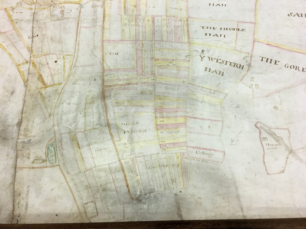
1624: part of map of Sandore Sutton estate (Pond on left hand side of map). Note: Sutton Drove runs from top to bottom of map on right hand side of Pond. (Map courtesy of The Keep).
Introduction
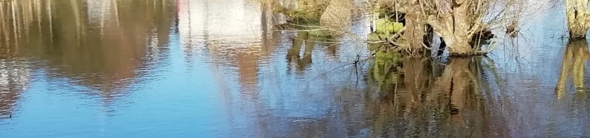
The East Blatchington Pond today nestles between the slopes of the Dane valley in which Sutton Drove and Vale Road run and appears trapped downstream by the embankment on
which Avondale Road sits. This may give today’s visitor the idea that the pond is a modern
creation of the traffic engineer. Nothing could be further from the truth. This paper sets out
a much more interesting story, through evidence, and a degree of conjecture supported by
several noted historians. This story is intrinsically linked to the 2 key features of the medieval
landscape in which Seaford itself sits, namely, the Cinque Port, and the encircling Downland.
Ponds in chalk could only be maintained if they were lined with puddled clay, and so each of
these had a deliberate purpose, and were not accidents of nature. They were dew ponds to
help refresh livestock whilst out in the open Downland.
The Dane valley in history.
Today’s landscape of roads and houses masks the underlying topography of the Dane valley.
I have called it the Dane Valley because that name occurs both in Dane Road, and, before that
road got that new name (it was once known as Green Lanes), there were 2 properties called
Dan/Dane Cottage (where Rowland Gorringe’s now sits), and Dan/Dane House, (Barracloughs
and the former Diella’s Restaurant).
The pond sits in an unnamed dry chalk valley, which, during the last Ice Age, had rendered
the permeable chalk hard, because it was frozen. This enabled rain and meltwater to carve
out the valley sides as water drained from the area around what is now Lexden Road, down
Vale Road, Blatchington Road, Brooklyn Road and out to The Salts. By Roman times sea levels
had risen and the lower valley from the pond to the sea was regularly flooded, enabling the
tide to further carve out the valley sides, until silt, and shingle turned the valley bottom into
a salt marsh, that was occasionally flooded by storm-driven high tides. Even as recently as the
great storm of 23 November 1824, the sea came up to the pond and local historian Thomas
Horsfield tells in his account written in 1835 of the ‘carp and tench, whose ancestors had dwelt
there in safety for many generations’. ( Rodney Castleden ‘On Blatchington Hill’ 2011 page 103)
Blatchington pond is located in this valley, at the junction of Blatchington Road and Blatchington Hill. The importance of this location can only be appreciated when the pattern of land use during the post-Conquest period is understood.
There are 2 references in historical documents that help illuminate the purpose of the pond.
The first is in 1226 when Louis F Salzman in his book The Chartulary of the Priory of St Pancras
Lewes Vol 1 SRS Vol 38 Vol 1 SRS p180 1933 records that Robert Peverell son of Robert
Peverell, prior to his death in this year, gifts to the Prior of St Pancras the land which his father,
Robert Peverell gave, “namely the land beside the mill of Sefford upon which the mill of the
pond is established namely the marsh and the sluice and all that the water covers”. Thus the
initial purpose of the pond was as a watermill rather than as a dewpond. As Seaford grew the
aspect of the pond as a watering hole for animals may well have replaced the role as millpond,
especially if the upstream watercourse dried up making a regular supply of water untenable.
Brief overview of Seaford as Cinque Port
Seaford as a town does not appear in the Domesday book, and is therefore generally
understood to have been a creation of trade between southern England and Europe in the
medieval period, during which time it obtained Cinque Port status, circa 1229. 1229 is also
an important year as it was when King Henry III decided to invade France to recapture
territory lost by his predecessor King John 1 and he needed ships to transport his invasion
army. In more peaceful times, its chief exports included fleeces and hides from animals raised
on the down lands and beyond. It flourished until the Black Death came in 1348, after which
its function as a port dwindled until in the late 1400’s, the harbour became gradually choked
by the mass of encroaching shingle that was pushed by the sea across the harbour mouth.
Thereafter, the pond chain was less vital but the feature itself endured, as can be seen in the
map drawn in 1624 (see above). Blatchington Pond probably became just another pond,
clearly used for fish, according to Thomas Horsfield’s account and occasionally as a means of
regulating social order through the ducking stool.
Land use and Droveways
The farmland on the south-facing dip slopes of the South Downs was held in very large
estates, such as Sandore and Sutton, centred upon the manor house that is now Sutton Place,
the Blatchington estate centred on Blatchington Court, and the Bishopstone/Denton estate
centred on Bishopstone Manor. These estates were, over time, in the ownership of families
linked to William the Conqueror, then monastic houses followed by powerful families after
the Dissolution of the monasteries, which started in 1536. The agricultural system in the
medieval period was a mix of cereal growing and sheep, with the sheep enriching the wheat
fields with their dung as they grazed them in a rotational system.
The role of Firle Road & Blatchington Hill as the southern end of a livestock drove goes back
at least to the same era, as several tenants of land in the manor of Blatchington also held land
in Alciston, a small village nestling at the foot of the South Downs escarpment, below Firle
Beacon, near to Bostal Hill. Alciston and Blatchington were linked through the monastic
system, both being under the jurisdiction of Battle Abbey until the Dissolution of that Abbey
in 1538. Since Battle Abbey and Alciston Manor were linked by the Abbey’s founder, William
the Conqueror, it is possible these links between the 2 Manors of Alciston and Blatchington
go back to the 11th century. The route for the Alciston livestock was up the scarp face where
the aptly named Bo Peep quarry is today, and across the Downs via the track known now as
Green Way, across what is now the Blatchington Golf Course, and so into Firle Road. These
dewponds therefore were part of a network to keep the animals refreshed. It is likely
therefore, that the livestock would then be driven down Blatchington Road and onto the salt
marshes now known as The Salts, where they would be sheared, and their fleeces exported
from Seaford to northern France. Between Easter 1286 and Easter 1292 50 or so merchants
exported from Seaford, 17 being local men, the rest coming from Sussex, and even St Omer. (Colin Brent, ‘Pre-Georgian Lewes 2004 page 127)
Sutton Drove, which meets the Pond from the east, was the end of a routeway that came
from the lands beyond Alfriston and the scarp face of the South Downs.
It is also possible that the Eastbourne Road (A259), from Chyngton Lane to the junction with
the Alfriston Road, was also a drove for the farms in and around that part of the Cuckmere
Valley, as well as Chyngton Farm itself.
The Bishopstone/Denton routeway leaves Bishopstone via Silver Lane, and veers south-east
about 700m out of the village to cross Valley Dip by the still-existing footpath and met with
Firle Road where the twitten links Beacon Drive with Firle Road (where there was a small pond
also).
The confluence of these 3, possibly 4, old drove ways was Blatchington Pond. The 1624 map
of the Manor of Sandore Sutton, surveyed by John de Ward, and commissioned by Sir
Benjamin Pellatt (see above) shows the estate extended along what is Sutton Drove as far as
the junction of Blatchington Hill and Blatchington Road to the East Blatchington parish
boundary. Sutton Drove is therefore one of the main medieval drove routes serving Seaford
from the direction of Alfriston and the area.
The 1624 map shows Blatchington Pond with Sutton Drove on the southern edge (where the path now runs, with Blatchington Hill rising northwards from the western side of the pond (where Avondale Road now runs). The pond is depicted as a large feature, with a cluster of 3
houses on its north side presumably where 2 Blatchington Hill now sits.
The 1840 Tithe map of East Blatchington Parish shows this clearly, with the pond still being
much larger than it is today. The 1840 map also shows that it was one of a number of ponds in the parish.
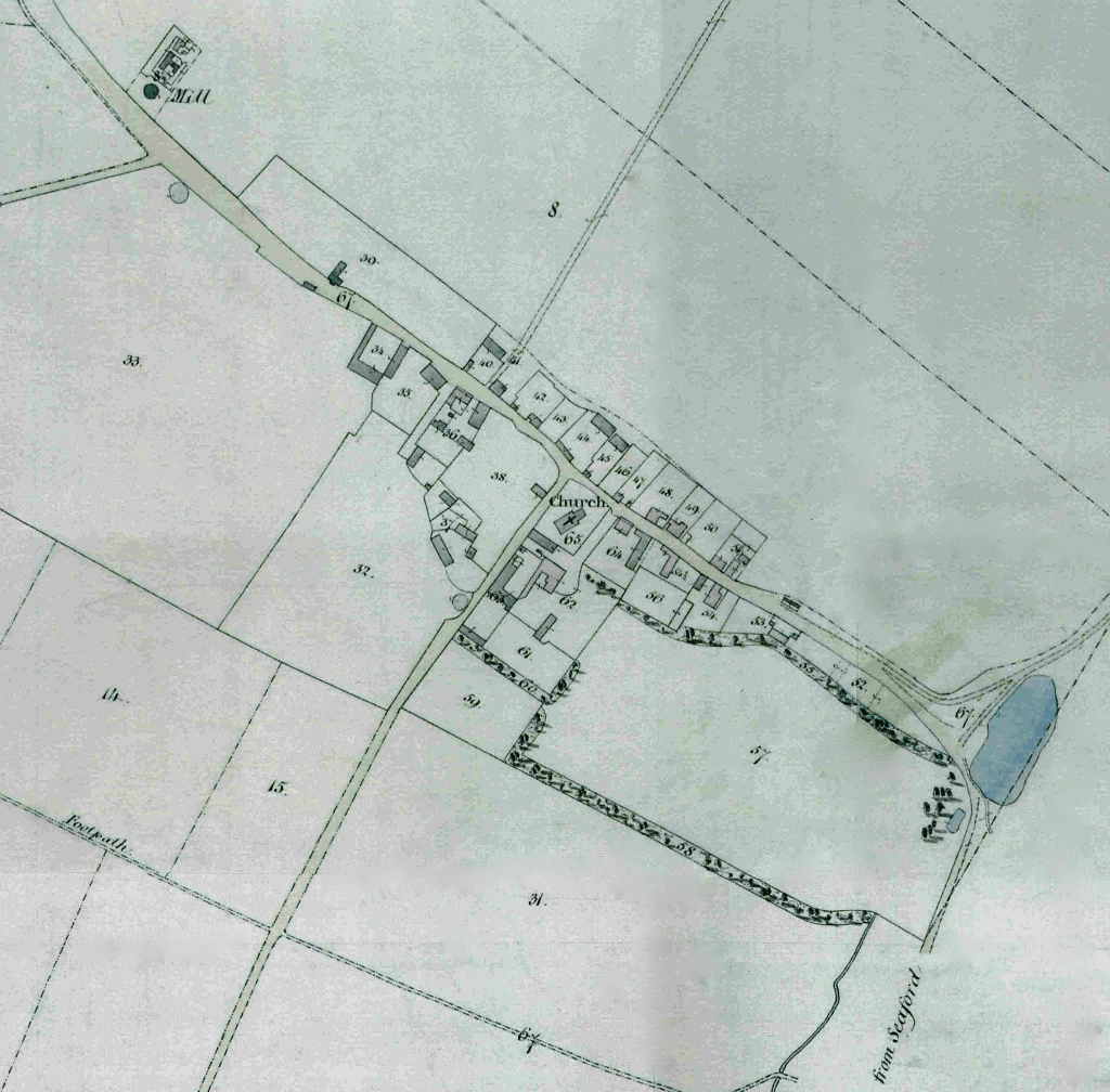
1840 Tithe map of East Blatchington. (Map courtesy of The Keep).
Other local ponds
One, in the grounds of Blatchington Manor (marked 57 on the map), was called ‘The Lily Pond’ until it was filled in and built over in the 1930s with a house (Redcourts, later renamed Elmcourt). Another pond can be seen on Belgrave Road near Field Cottage and a further one beside the Twitten that leads across Valley Dip to Bishopstone. The full map also shows one outside St John’s School campus, in Firle Road. The age of these ponds cannot be known, and it is possible that they served a more local function for local farms, where they are located on private land.
A picture of the Lily Pond exists in Seaford Museum and shows this 2nd pond, the ‘twin’ on the opposite side of Blatchington Road. This pond is shown as within the private grounds of Blatchington Court, and was on a part of the grounds that was ceded by Elizabeth Dennis in 1892 to become glebe land of the church, and so is likely to not have been used by drovers to water their animals.
1903: The Lily Pond (site of Elmcourt). (Photo courtesy of Seaford Museum)
Blatchington Pond in the 20th century
The photo below shows the pond just after Avondale Road had been constructed providing a
new link with Seaford, and effectively ‘damming’ the pond and reducing it in size to its present
shape.
This area assumed greater importance in the period leading up to WW1. Housing
development was coming down Blatchington Hill and Avondale Road. To reflect the increasing
municipal importance of the pond, the freeholder, the Seaford West Company just a fortnight
before the outbreak of war, sold the land to Seaford Urban District Council with restrictive
covenants limiting its use to public pleasure grounds. After the war, development slowly
picked up again, with Elmcourt (originally a small hotel called Redcourts) being built in the
late 1920’s on the site of the Lily Pond, and Norlington House, an attempt to re-create Place
House (a Jacobean house that was located on the corner of Place Lane and Broad Street, Seaford.)

1905: Blatchington Pond and Hill. (Picture courtesy of Seaford Museum)
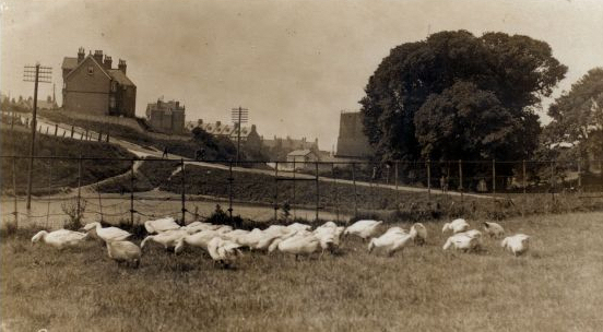
1927: geese grazing beside the pond. (Photo courtesy of Seaford Museum).
The Sutton Drove housing development came in the 1930s finally bringing an appreciative local community to gradually transform what was an agricultural valley separating Seaford and East Blatchington to a single urban entity.
